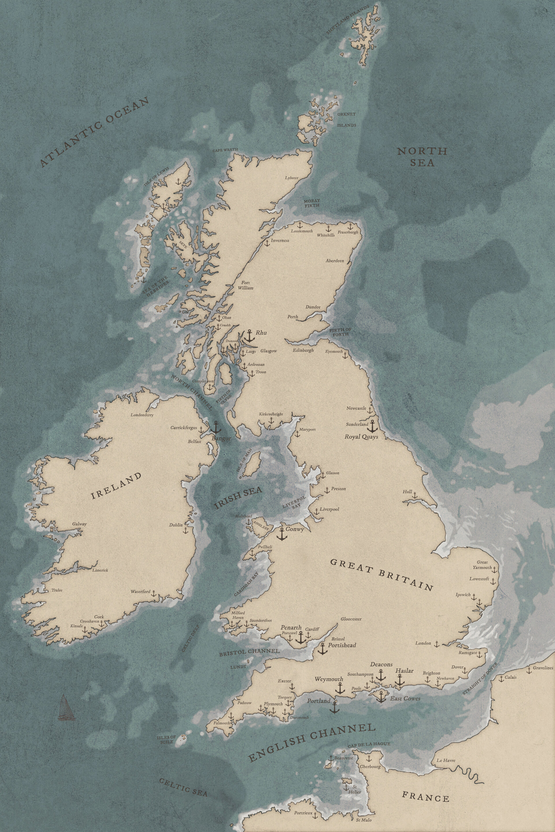
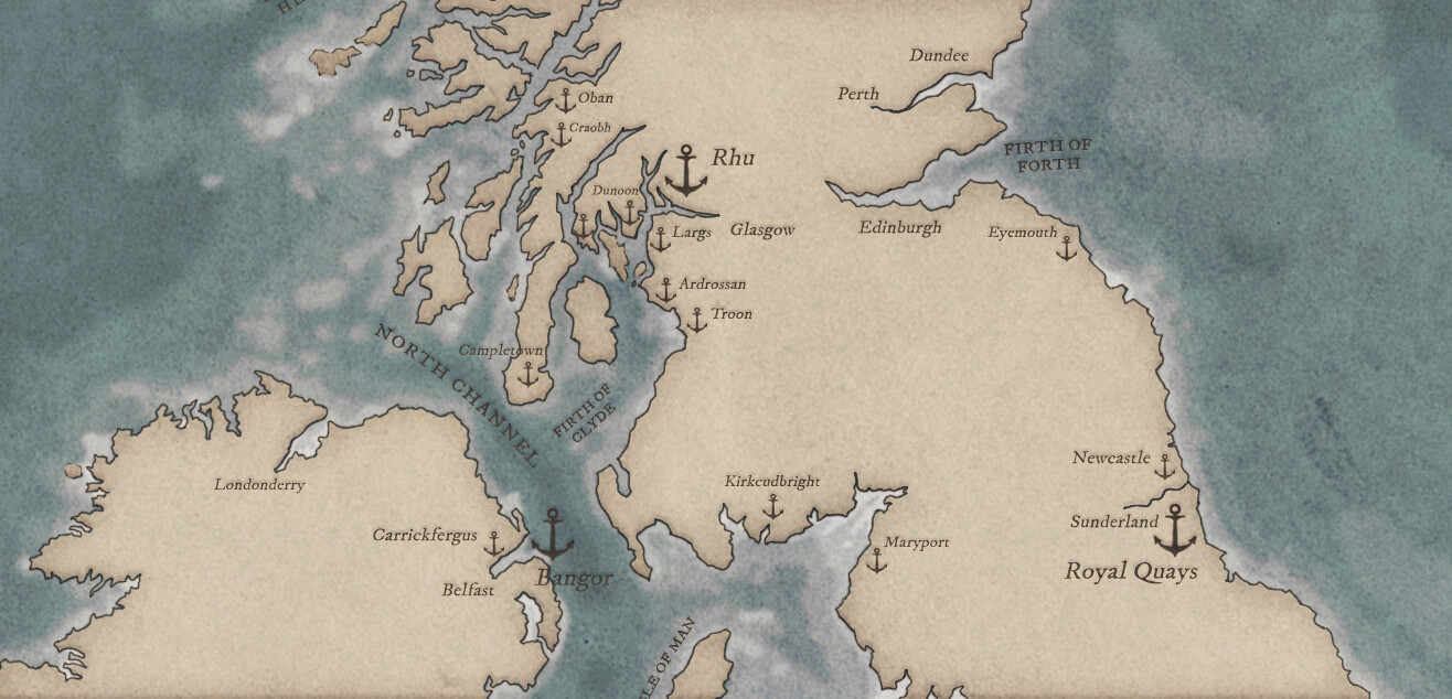
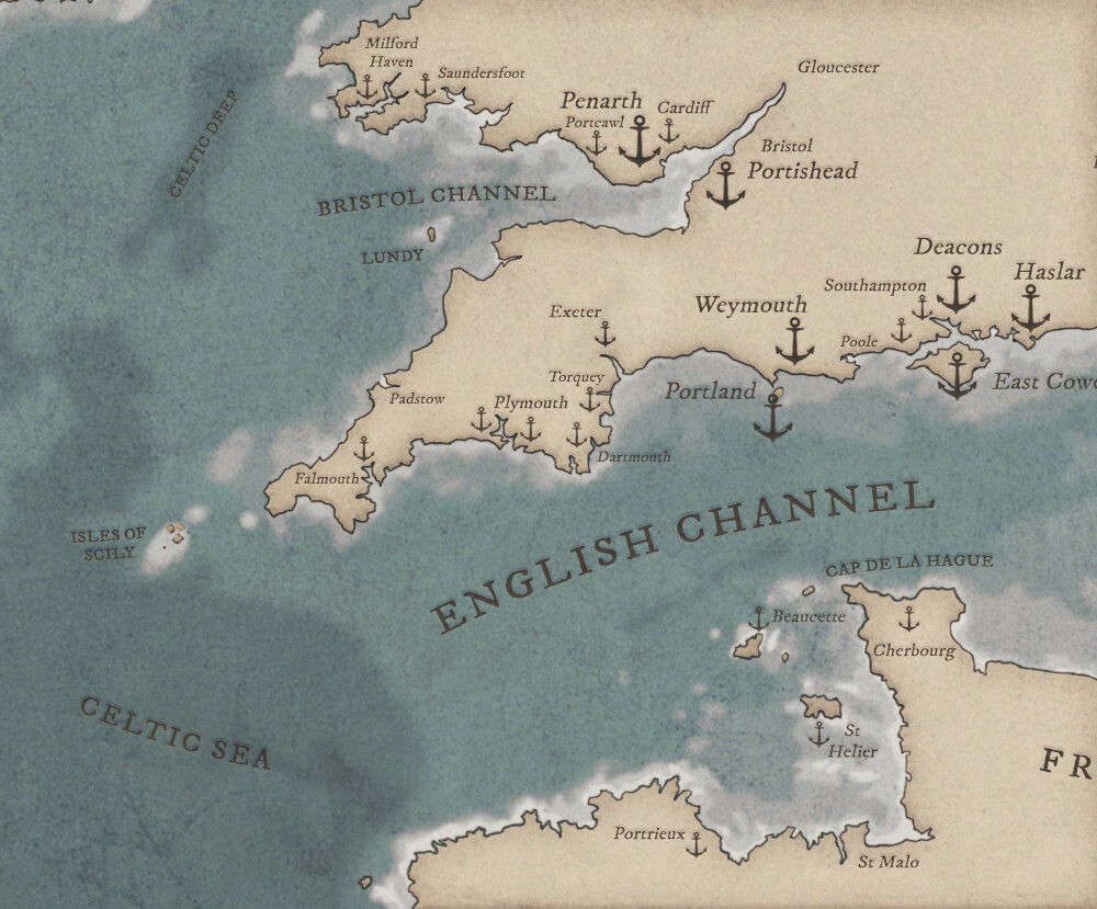
A map of the coastline of the British Isles. My aim was to create a map that was both attractive and able to provide useful sailing information at a glance. I wanted to give it the feel of an old nautical chart, although I took some liberties with colour in order to separate land and sea more clearly. The different shades of blue represent the sea depth and the anchors represent marinas. The larger anchors are for marinas that are part of the 'Boatfolk' group.